For dealers, traders and professional buyers · Civilian industrial positioning
Opening: When a client says "I need to scan hundreds of square kilometers a day", what do you hand them?
After a while in this business you will notice the client request always starts from a number: "My jurisdiction covers thousands of square kilometers, I need to see how it changes over time"; "This transmission line crosses three provinces, crews on foot cannot keep up"; "The mine has to produce a monthly earthwork volume report."
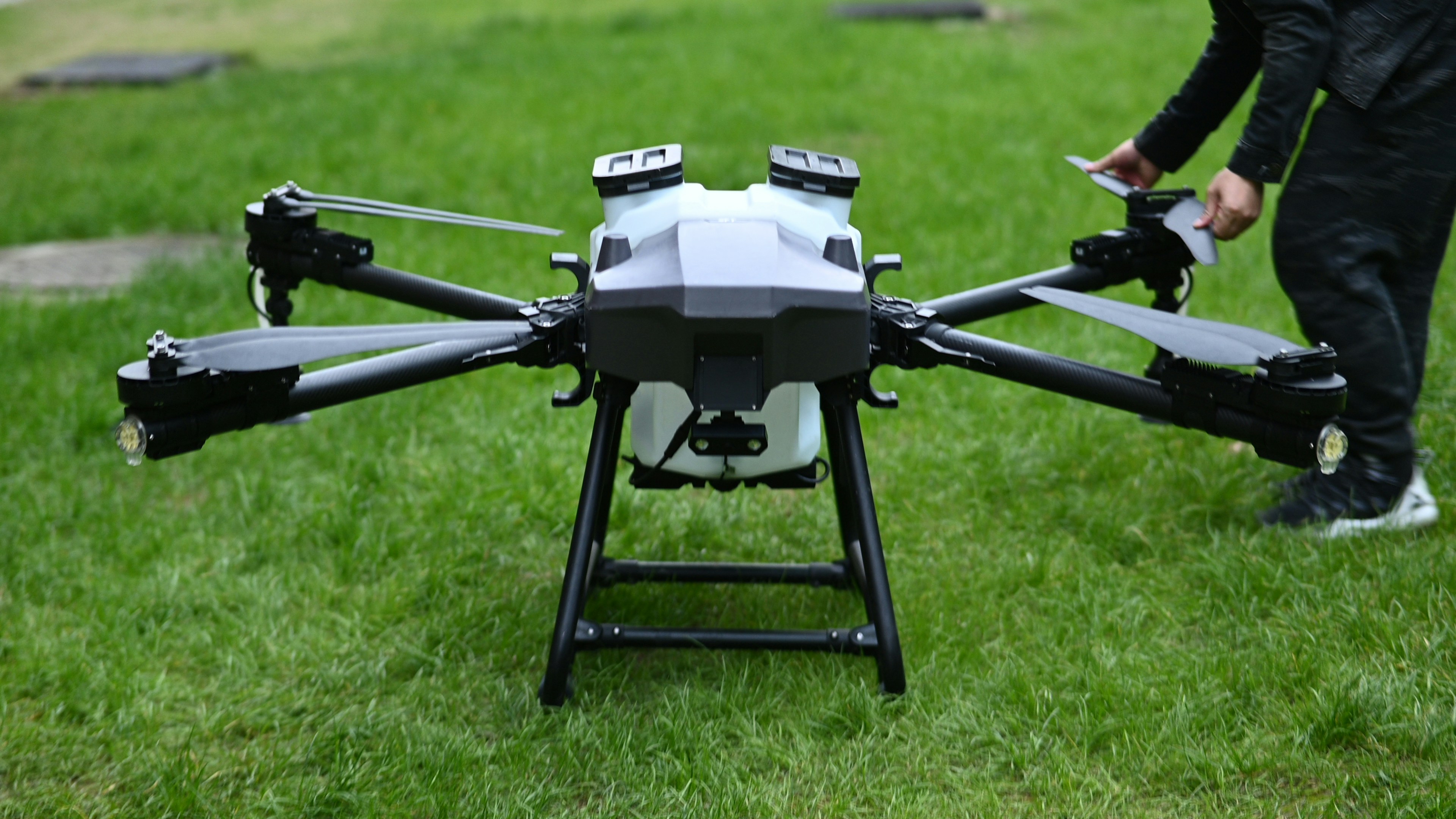
Multicopters start to look stretched at that point: 40 minutes of flight, a dozen kilometers of range, and one sortie covers maybe the size of a palm. To cover wide-area tasks you either send a fleet of trucks back and forth, or you charter a manned aircraft — both are expensive.
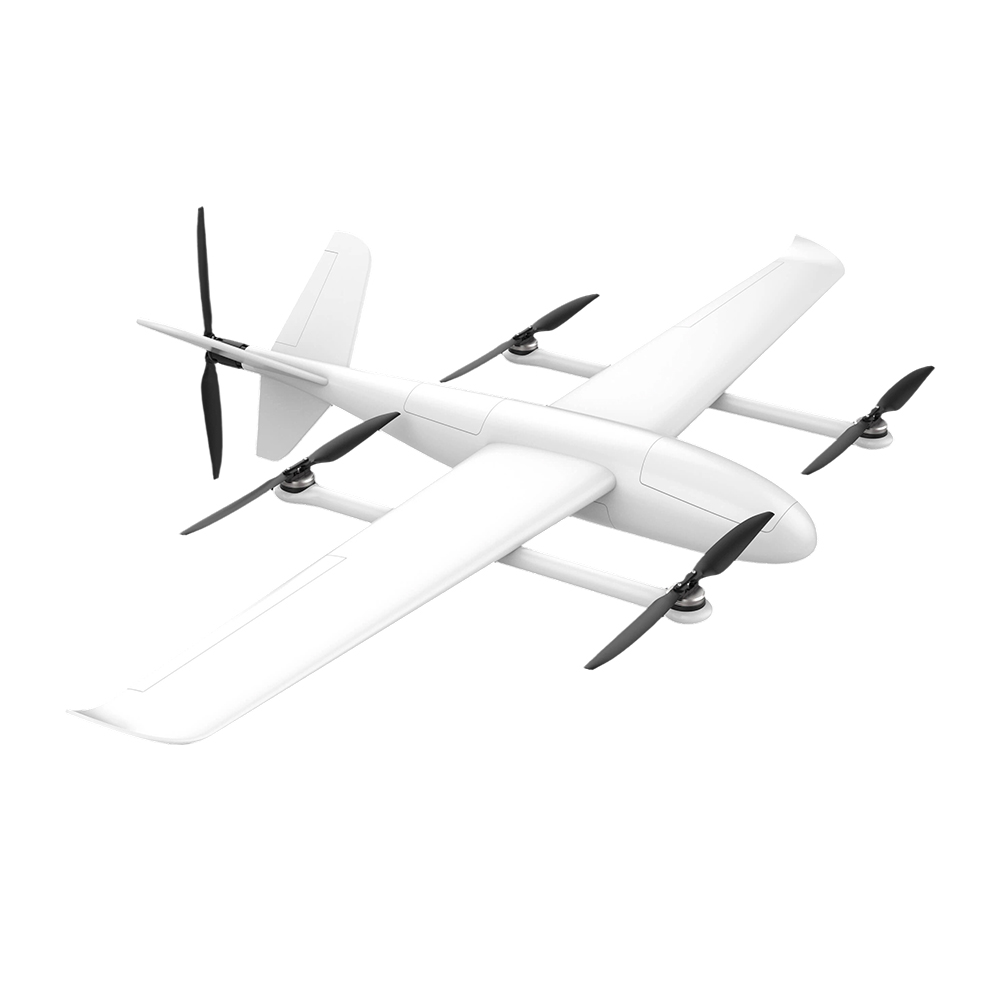
That is exactly the gap the FY-VT04, a vertical take-off and landing fixed-wing (VTOL) UAV, is built to fill. It combines the multicopter's convenience of "any flat ground will do for take-off and landing" with the fixed-wing's efficiency of "glide on the wing, fly long, fly far." One FY-VT04 sortie replaces several multicopter sorties, and a full day's work can be done in a single trip.
This guide follows a fixed order: what it is, how it does it, what civilian use cases fit, where the real limits are, why the market is growing, and how to pick the right tool for the job.
What the FY-VT04 Is: 4+1 Vertical-Take-Off Fixed Wing, Specs on the Table
The FY-VT04 is a 4+1 vertical take-off and landing fixed-wing UAV: four rotors handle vertical take-off and landing, one fixed wing handles cruise. The parameters below are taken straight from our product catalog:
| Parameter | Value | Parameter | Value |
|---|---|---|---|
| Configuration | 4+1 VTOL fixed-wing | Body length | 1260 mm |
| Wingspan | 2500 mm | Empty weight | 11.8 kg |
| Max take-off weight | 13.8 kg | Max payload | 2.0 kg |
| Endurance (empty) | 240 minutes | Endurance (with 1.5 kg payload) | 140 minutes |
| Cruise speed | 68–94 km/h | Wind resistance (fixed-wing mode) | Beaufort 7 |
| Max working altitude | 4800 m | Rain tolerance | Operates in moderate rain |
| Ground-station control range | 30 km | Body material | Carbon fiber / fiberglass / Kevlar |
One line to remember it: of a near-14 kg take-off weight, only 2 kg is set aside for mission equipment — the rest is traded for "fly longer." The empty-airframe four-hour figure is more than six times what most multicopters deliver.
How It Gets "Long Endurance"
The core is one sentence: rotors for take-off and landing, wings for cruise.
- Take-off and landing phase: four motors provide lift, the platform is not picky about ground — a rooftop, a pickup truck bed, a flat patch in the field will all work. No runway needed, which is something conventional fixed-wing take-offs cannot do.
- Cruise phase: once the airframe transitions to fixed-wing flight, the wings generate lift to support the airframe and the motors only have to overcome drag — aerodynamic efficiency buys you time. That is where the 240-minute figure comes from. It is not from packing more battery; it comes from "knowing how to fly."
- Light but rigid airframe: the carbon fiber / fiberglass / Kevlar hybrid structure balances stiffness and weight at 11.8 kg empty — that is the prerequisite for long endurance.
- Real working conditions handled: Beaufort 7 wind resistance (in fixed-wing mode), operates in moderate rain, up to 4800 m working altitude — these three determine whether the FY-VT04 actually works in the Middle East heat and high plateau, and in African rainy seasons, instead of only flying in "calm and clear" weather.
Where It Is Used: Four Civilian Scenarios, All from Real Operating Logic
1. Topographic Mapping / Wide-Area Modeling
Fixed-wing cruise efficiency shows up most directly in mapping work. For an area of several hundred square kilometers, multicopters need dozens of sorties to stitch the imagery together; the FY-VT04, flying a planned route in a single sortie, can sweep a large area in one go and return with the data for an orthophoto or a 3D model. Mapping providers, mine volume surveyors and city-planning base-map producers are the typical clients in this segment.
2. Power and Pipeline Inspection
Transmission lines and oil & gas pipelines are linear assets — they run for hundreds of kilometers along a route. Multicopters are constrained by endurance; the FY-VT04's advantage in cruising along a line is obvious. In industry cases, VTOL-class platforms can cover dozens of kilometers of line per sortie, while multicopters are usually limited to a few kilometers. A transmission corridor running tens of kilometers through desert is exactly its home turf.
3. Lightweight Resupply
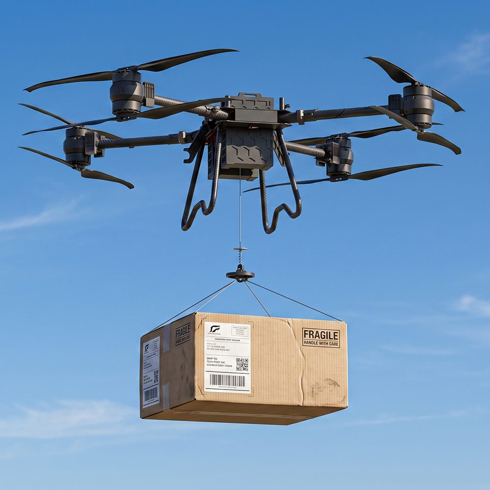
What can 2 kg of payload do? Emergency medicines, first-aid consumables, small communications-relay gear, surveying reference-point equipment — the kind of "small but urgent" items. It fits "far and light" scenarios — for example, urgent supplies to a remote site. Note: this is a light-payload platform. Cargo above 2 kg belongs on a heavy-lift cargo drone (see related reading at the end). The two platforms are clearly divided.
4. Disaster Monitoring / Large-Area Rapid Assessment
After floods, forest fires or wind damage, the first priority is "which area is hit and which roads are still passable." The FY-VT04 takes off quickly, flies far, and in a single sortie can map the outline of a disaster zone and stream the imagery back to command for dispatch. The whole use case stays within civilian emergency response.
The Real Edges of "Long Endurance" (Three Things a Dealer Has to Be Straight with the Client About)
1. The 240-minute figure is the empty-airframe ideal; quote the client based on payload.
At 0.5 kg payload it is about 220 minutes; at 1.5 kg it is about 140 minutes — the heavier the mission equipment, the more endurance shrinks. Do not promise the empty figure when pitching; quote the real payload number. That actually looks more professional.
2. 30 km is the ground-station control range, not the mission range.
It is the reliable radius for the control and video link, not "you can fly 30 km out and deliver." Real mission range is calculated as "cruise speed × usable endurance ÷ round trip," with a return margin on top. Control range ≠ one-way delivery distance — do not mix those two when quoting a client.
3. Environment and load both take their toll.
High altitude, strong wind, anything above moderate rain, and high temperatures all affect endurance and stability. The 4800 m altitude rating is "upper limit reachable," not "full power at any altitude." Spelling out the working conditions clearly with the client prevents a lot of post-sales arguments.
Why the Market Is Growing (Data-Driven)
- The global VTOL UAV market was about USD 5.1 billion in 2025 and is projected to reach about USD 15.0 billion by 2034, with a compound annual growth rate of about 13.5% (MarketsandMarkets).
- Fixed-wing VTOL segment: about USD 690 million in 2025 → about USD 1.2 billion by 2030, CAGR 11.7%, with the Middle East as the fastest-growing region (MarketsandMarkets) — right in our main market.
- In survey-grade UAVs, VTOL/hybrid-wing configurations already hold about 31.4% share; in the aerial-imaging platform sub-category, hybrid VTOL is the fastest-growing segment, at a CAGR of about 36.2% (PW Consulting / Market Research Future).
- Late 2025 saw a European fixed-wing vendor sign a Middle East general-distribution deal for an eVTOL mapping platform, showing that regional distribution networks are starting to position VTOL mapping platforms as the next category to push (source at the end of the article).
The signals line up: "long endurance + vertical take-off and landing" is moving from the mapping/inspection specialist circle into regular procurement, and the Middle East and African infrastructure and energy projects are exactly where that demand is most concentrated.
Common Misconceptions (The Honest Talk That Saves the Client Money)
| Misconception | The honest answer |
|---|---|
| "240 minutes of endurance means it can do 4 hours of airborne surveillance" | That is the empty-airframe ideal; once you add mission equipment and a return margin, you have to calculate against the real figure |
| "30 km control range = can deliver over 30 km" | Control / video range ≠ mission range, do not read it as a delivery radius |
| "Anything that can take off vertically must be slow" | Cruise speed is 68–94 km/h; in fixed-wing mode its efficiency is higher than a multicopter |
| "Only 2 kg of payload, not very useful" | It is positioned for wide-area light load (mapping, line patrol, small resupply); heavy cargo is a different platform's job |
| "VTOLs are military" | Civilian mapping, inspection and emergency response are the mainstream commercial use cases; this platform stays within civilian industrial positioning |
Customization and "Off-Catalog Sourcing"
Mission equipment on the FY-VT04 (mapping cameras, multi-spectral sensors, thermal imagers, etc.) is configured per project. If the client needs a model that is not in the catalog, or a non-standard payload, just tell us the requirement — our supply chain can source or customize per project. That is what "off-catalog sourcing" is for.
FAQ
What kind of client is the FY-VT04 right for?
It is aimed at mapping service providers, power and oil-and-gas inspection teams, emergency response organizations and government project contractors — clients that have a regular, wide-area, long-distance inspection need. Dealers can position it as the flagship product in the long-endurance category.
What is the real endurance in the field?
Empty airframe about 240 minutes; with 0.5 kg of mission equipment about 220 minutes; with 1.5 kg about 140 minutes. Real numbers vary with payload, wind, altitude and mission profile. When quoting, we recommend using the conservative value for the actual payload class.
How does it divide work with a multicopter?
Multicopters win on flexible hover, suited to "close, small, precise" point inspections. The FY-VT04 wins on endurance and coverage, suited to "far, large, long" area or linear missions. The two are complementary, not substitutes.
Can it fly in the rain?
It can operate in moderate rain — that is one of the bases for it being usable in rainy and changeable climate zones. Storms, hail and other extreme weather are not recommended, and that applies to any UAV.
Does it need a runway?
No. Vertical take-off and landing, any flat patch of ground is enough. Rooftops and pickup-truck loading platforms also work — that is a deployment flexibility conventional fixed-wing take-offs cannot match.
Is this a civilian or military product?
Civilian industrial positioning, aimed at mapping, inspection, emergency response and light resupply in commercial and public-service scenarios. No combat use.
Closing
Back to the question at the top: when a client says "I need to scan hundreds of square kilometers a day", the FY-VT04 is the tool that turns that into "one sortie after another, flown to plan" — long endurance, easy take-off and landing, and tough enough for the Middle East and African working conditions. The specs are on the table; what is left is matching them to the client's mission.
To discuss a specific configuration, a mission-equipment package, or a distribution arrangement, please tell us your requirement.
Related reading: TS100 Heavy-Lift Cargo Drone Field Guide (heavy cargo goes to it) | FPV Recon Drone Size Selection Guide (close-range maneuvering missions) | Remote-Area Drone Delivery Logistics Guide
---
*Data and scope note: market data is cited from MarketsandMarkets / PW Consulting / Market Research Future / Next Move Strategy Consulting public reports. The "VTOL line-coverage on the order of dozens of km per sortie" figure is from industry cases cited by PW Consulting; the actual distance depends on the line and the platform. The control range and endurance figures quoted are platform specifications, not commitments of "single-trip delivery distance." Export-compliance requirements should be checked against the actual project context [manual verification required].*